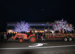
Summer is the busiest season of the year on the Olympic Peninsula. With Olympic National Park as the centerpiece of the peninsula, there are many well-known places you might have your heart set on visiting, but may find very crowded this time of year. We’ve got some tips and alternatives to consider when you want to explore the magnificent natural beauty of this region without throngs of people.
Insider Tip: Visit during off-peak times
Weekends and holidays are always the busiest times to visit, so why not plan to come mid-week. Remember, too, that our longer summer days offer up to 16 hours of daylight here on the Olympic Peninsula. So grab a cup of strong coffee and head out early before most visitors are awake, or wait until later in the day. The goal is to avoid the mid-day crowds. Want to get some amazing photos? Local photographers know that the best light for those magical shots is either early in the morning or during the evening’s “golden hour.”
Here are some less-crowded alternatives on the Olympic Peninsula.
Olympic National Forest, State and County Parks
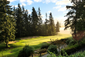
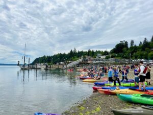
Olympic National Forest nearly encircles Olympic National Park, covering over 633,000 acres with hundreds of trails, many wandering through old-growth forests. It offers a gorgeous alternative to the national park with an array of campgrounds that are available too. This diverse landscape ranges from rain forests to canyons to high mountain ridges. In addition, there are 20 state parks and nearly 100 county, city and privately operated parks for outdoor recreation with hiking, fishing boating and camping facilities. Check out Clallam, Jefferson, Grays Harbor, and Mason County Parks.
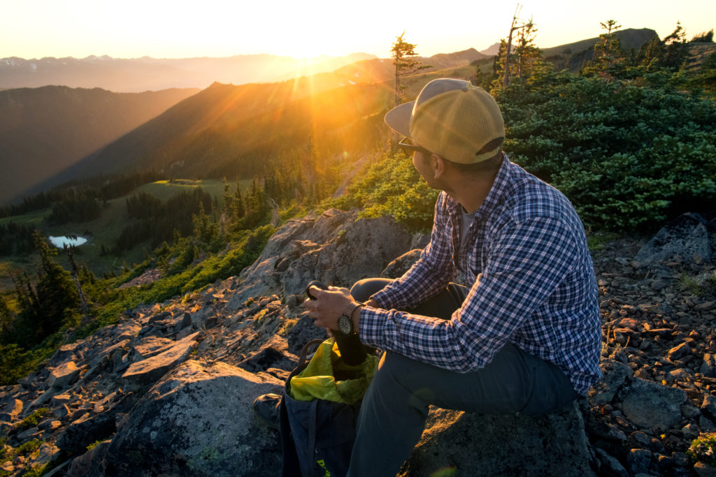
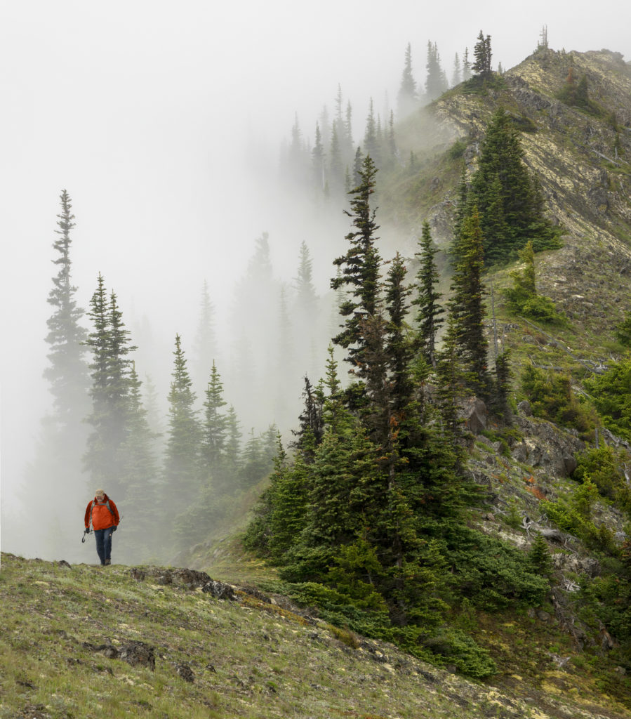
Breathtaking Vistas and Viewpoints
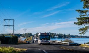
Hurricane Ridge is known for its incredible 360-degree views. On a clear day you can see the Strait of Juan de Fuca, Mt. Baker and Vancouver Island, Canada in the distance. It’s also one of the most popular vantage points in Olympic National Park, so it can get busy! One way to make visiting Hurricane Ridge easier is to take Clallam Transit’s Shuttle Bus. Leave your car behind and for only $1 each way for adults, there are three trips daily, seven days a week, up the mountain and back.
An alternative to Hurricane Ridge is to visit Deer Park above Port Angeles (NOTE: 4-wheel drive is recommended since it’s a primitive road, but with a spectacular view!). Another option for a breathtaking vista is Mount Walker Trail between Quilcene and Brinnon on the eastern side of the peninsula. It’s a 5.4-mile out-and-back trail with a 2,240-foot elevation gain. Parking is located just off US Hwy. 101. You can also drive 4.25 miles from US Hwy. 101 along Mount Walker Road, also known as Forest Road #2730.
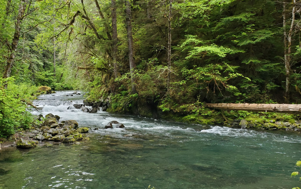
Rain Forests
Although the Hoh Rain Forest gets all the love and attention, there are three other temperate rain forests (among the few on the planet) around the Olympic Peninsula to enjoy. In addition to the Hoh, you can visit Queets, Quinault and Bogachiel valleys. These are emerald wonderlands with moss-draped trees and lush ferns carpeting the forest floor. You won’t find crowds in the Queets Rain Forest so you can indulge in the quiet, damp beauty of this more remote region. Or wander through the hanging mosses, old-growth cedar and spruce trees in the Bogachiel Rain Forest. The Quinault Rain Forest is home to the world’s largest Sitka spruce tree that’s over 1,000 years old.
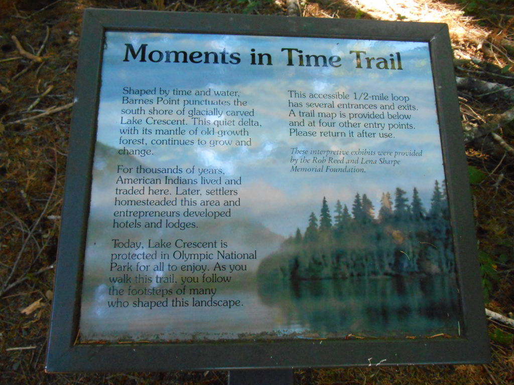
Limited time, or looking for something for the little ones? Consider the alternative of exploring the Moments in Time Trail at Lake Crescent. Or check out the Ancient Groves Nature Trail off the Sol Duc Hot Springs Road. Either will give you that rain forest experience.
Beaches
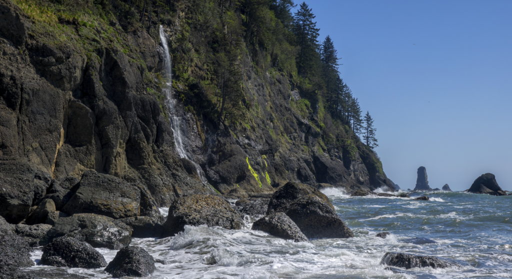
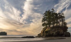
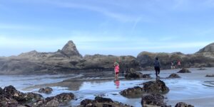
Olympic National Park boasts over 65 miles of wild, rugged, fragile coastline with dramatic sea stacks, crashing waves, tidepools and sandy shores for walking and exploring. Ruby Beach is a favorite but is closed this summer for maintenance until mid-September 2022. No worries, though, there are many other stunning options nearby such as Kalaloch Beach where you can see the famous “Tree of Life” or a bit further south, go tide pooling at low tide on Beach 4.
Further north, west of Forks, is Rialto Beach. The parking lot can fill up fast especially at low tide when it’s easiest to trek to Hole in the Wall. If you plan to visit, get there early, or go at mid-tide and forego the jaunt to Hole in the Wall. Alternative coastal beach locations include Second Beach near La Push, a 4-mile round trip hike with views of sea stacks, wildlife and waves crashing against the rocks. Another alternative is Third Beach just down the road, but even at 3.6 miles round trip, it’s a more challenging hike. The prize, however, is seeing a waterfall plunge into the ocean.
For other alternative beach ideas, check out our “10 Uncrowded Beaches” blog.
Waterfalls
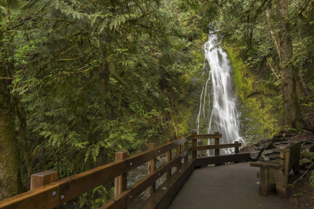
Who doesn’t love chasing waterfalls?! And the Olympic Peninsula has them in spades. Sol Duc Falls is another well-known destination with the potential to be crowded in the summer. But there are nearby alternatives. At Lake Crescent, Marymere Falls can be easily accessed from the Storm King Ranger Station and is just under a 2-mile roundtrip with an elevation gain of 500 feet. Madison Falls is along the Elwha River and is one of the easiest waterfalls to get to plus it’s less than a quarter mile round trip on a flat, paved trail.
Other Considerations
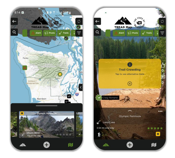
Before your visit, download the official National Park Service app. Also new this summer is the Washington TREAD Map app for your smart phone, offering real-time updates for and by outdoor enthusiasts and area land managers. Both apps are available through the Apple App Store or Google Play.
Remember wherever you go this summer, please practice “Leave No Trace” by packing out what you pack in. Stay on the trails, don’t feed or get close to wildlife, and let someone know about your trip. Please #RecreateResponsibly.
Cover photo courtesy of State of Washington Tourism